Camoël
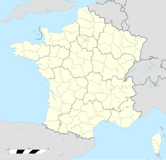
Camoël (Gallo Camóèu, bretonisch Kamoel) isch e franzesischi Gmai im Département Morbihan in dr Region Bretagne.
| Camoël | |
 | |
| Verwàltung | |
|---|---|
| Land | |
| Region | |
| Département | Morbihan (56) |
| Arrondissement | Vannes |
| Kànton | Muzillac |
| Kommünàlverbànd | Presqu'île de Guérande Atlantique |
| Àmtliga Nàma | Camoël |
| Maire | Bernard Le Guen (2014-2020)[1] |
| Code Insee | 56030 |
| Poschtlaitzàhl | 56130 |
| Iiwohner | |
| Iiwohner | 1.122 |
| Flech | 14,33 km2 |
| Bevelkerungsdicht | 61,48 Iiw./km2 |
| Làg | |
| Koordinate | 47° 28′ 55″ N, 2° 23′ 42″ W / 47.481944444444°N,2.395°WKoordinate: 47° 28′ 55″ N, 2° 23′ 42″ W / 47.481944444444°N,2.395°W |
| Heche | 32 m |
| Website | |
| https://www.camoel.fr | |
D Gmai ghert zum Kanton Muzillac un zum Arrondissement Vannes.
Geografi ändere
Camoël lyt 33 km vu Vannes un 78 km vu Lorient uf ere Hechi zwische 0 m un 44 m iber Normalnull. Nochbergmaine sin Arzal im Norde, Pénestin im Weschte, Férel im Oschte un Assérac im Side.
Gschicht ändere
Camoël isch zum erschte Mol gnännt wore anne 557 as Carmoil (1287: Camoil, 1557: Camoel).
Verwaltig ändere
Dr Maire vu Camoël isch dr Bernard Le Guen. Camoël ghert zum Kommunalverband Presqu'île de Guérande Atlantique.
Bevelkerigsentwicklig ändere
| Johr | 1962 | 1968 | 1975 | 1982 | 1990 | 1999 | 2008 |
| Yywohner | 574 | 541 | 479 | 559 | 598 | 655 | 831 |
Dialekt ändere
Dr traditionell Dialäkt vu Camoël ghert zum Gallo. Anne 1806 het d Gmai noch em Charles Coquebert de Montbret no zum bretonische Sprochbiet ghert.
Kultur un Böuwärch ändere
- Église Camoël
- Chapelle Notre-Dame de la Salette
- Fontaine Notre-Dame de la Salette
-
Chapelle Notre-Dame de la Salette -
Fontaine Notre-Dame de la Salette
Weblink ändere
Commons: Camoël – Sammlig vo Multimediadateie
- https://web.archive.org/web/20191018091323/https://www.cap-atlantique.fr/
- Camoël uf geobreizh.com (Internet-Archive)
Fueßnote ändere
- ↑ Liste des maires au 25 avril 2014 (data.gouv.fr)
