Datei:Ireland relief location map.png
Greßi vu däre Vorschau: 481 × 599 Pixel. Wyteri Ufflösige: 192 × 240 Pixel | 385 × 480 Pixel | 616 × 768 Pixel | 822 × 1.024 Pixel | 1.450 × 1.807 Pixel.
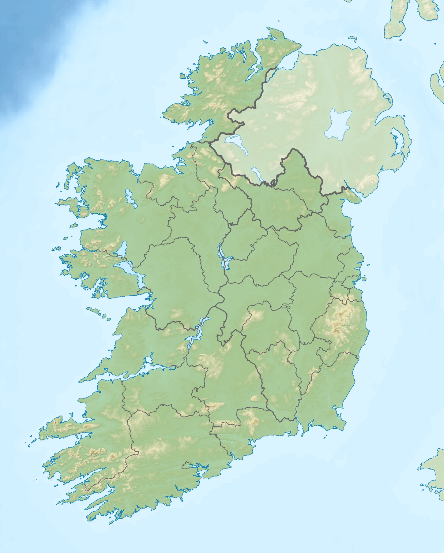
Originaldatei (1.450 × 1.807 Pixel, Dateigrößi: 1,55 MB, MIME-Typ: image/png)
| Die Datei un d Informatione derzue were us em zäntrale Mediearchiv Wikimedia Commons (Allmänd) iibunde. | Zur Bschriibigssite uff de Allmänd |
| Bschryybig |
Relief location map of Ireland Equirectangular map projection on WGS 84 datum, with N/S stretched 170% Geographic limits:
|
| Datum | |
| Quälle |
Shuttle Radar Topography Mission
National Geospatial-Intelligence Agency
File:Ireland location map.svg: NordNordWest
|
| Urheber | Nilfanion |
| Gnähmigung (Wyternutzig vu däre Datei) |
Die Datei isch lizänziert unter dr Creative-Commons-Lizenz Namensnännig – Wytergab unter glyche Bedingige 3.0 nit portiert.
|
| Anderi Versione |
.png)

Dateiversione
Klick uf e Zytpunkt zu aazeige, wie s dert usgsäh het.
| Version vom | Vorschaubild | Mäß | Benutzer | Kommentar | |
|---|---|---|---|---|---|
| aktuell | 10:32, 24. Aug. 2020 | | 1.450 × 1.807 (1,55 MB) | Jacobfrid | Reverted to version as of 12:29, 12 September 2014 (UTC) |
| 14:17, 23. Aug. 2020 |  | 324 × 280 (90 KB) | Jacobfrid | Cropped 78 % horizontally, 85 % vertically using CropTool with precise mode. | |
| 14:29, 12. Sep. 2014 |  | 1.450 × 1.807 (1,55 MB) | NordNordWest | Local Government Reform Act 2014 | |
| 02:02, 23. Okt. 2012 |  | 1.450 × 1.807 (1,56 MB) | Nilfanion | Fix UK shading nr Londonderry | |
| 00:43, 16. Apr. 2012 |  | 1.450 × 1.807 (1,56 MB) | Nilfanion | {{Information |Description=Relief map of Ireland Equirectangular map projection on WGS 84 datum, with N/S stretched 170% Geographic limits: *West: 11.0° W *East: 5.0° W *North: 55.6° N *South: 51.2° N |Source= [[w:Shuttle Radar Topo... |
Verwändig vu dr Datei
Di folgende Sytene händ en Link zu dem Bildli:
Wältwyti Dateinutzig
Die andere Wikis bruche die Datei:
- Gebruch uf am.wikipedia.org
- Gebruch uf ar.wikipedia.org
- Gebruch uf ast.wikipedia.org
- Gebruch uf azb.wikipedia.org
- Gebruch uf ban.wikipedia.org
- Gebruch uf ba.wikipedia.org
- Gebruch uf be-tarask.wikipedia.org
- Gebruch uf bn.wikipedia.org
- Gebruch uf br.wikipedia.org
- Gebruch uf bs.wikipedia.org
- Gebruch uf bxr.wikipedia.org
- Gebruch uf ca.wikipedia.org
- Gebruch uf ceb.wikipedia.org
- Gebruch uf cs.wikipedia.org
- Gebruch uf cv.wikipedia.org
Wältwyti Verwändig vu däre Datei aaluege.