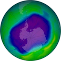
Datei:NASA and NOAA Announce Ozone Hole is a Double Record Breaker.png

Greßi vu däre Vorschau: 600 × 600 Pixel. Wyteri Ufflösige: 240 × 240 Pixel | 480 × 480 Pixel | 716 × 716 Pixel.
Originaldatei (716 × 716 Pixel, Dateigrößi: 411 KB, MIME-Typ: image/png)
Dateiversione
Klick uf e Zytpunkt zu aazeige, wie s dert usgsäh het.
| Version vom | Vorschaubild | Mäß | Benutzer | Kommentar | |
|---|---|---|---|---|---|
| aktuell | 04:40, 18. Feb. 2012 |  | 716 × 716 (411 KB) | Ras67 | JPEG artifacts mitigated and background removed |
| 22:29, 28. Aug. 2007 |  | 716 × 716 (409 KB) | Nils Simon |
Verwändig vu dr Datei
Di folgende Sytene händ en Link zu dem Bildli:
Wältwyti Dateinutzig
Die andere Wikis bruche die Datei:
- Gebruch uf af.wikipedia.org
- Gebruch uf ar.wikipedia.org
- Gebruch uf az.wikipedia.org
- Gebruch uf be.wikipedia.org
- Gebruch uf bg.wikipedia.org
- Gebruch uf bn.wikipedia.org
- Gebruch uf bs.wikipedia.org
- Gebruch uf ca.wikipedia.org
- Gebruch uf cs.wikipedia.org
- Gebruch uf cv.wikipedia.org
- Gebruch uf de.wikipedia.org
- Gebruch uf de.wikibooks.org
- Gebruch uf el.wikipedia.org
- Gebruch uf en.wikipedia.org
- Gebruch uf en.wikibooks.org
- Gebruch uf en.wikinews.org
- Gebruch uf es.wikipedia.org
Wältwyti Verwändig vu däre Datei aaluege.

