Datei:Reliefkarte Normandie.png
Greßi vu däre Vorschau: 800 × 537 Pixel. Wyteri Ufflösige: 320 × 215 Pixel | 640 × 429 Pixel | 1.024 × 687 Pixel | 1.280 × 859 Pixel | 2.560 × 1.717 Pixel | 3.691 × 2.476 Pixel.
Originaldatei (3.691 × 2.476 Pixel, Dateigrößi: 9,25 MB, MIME-Typ: image/png)
| Die Datei un d Informatione derzue were us em zäntrale Mediearchiv Wikimedia Commons (Allmänd) iibunde. | Zur Bschriibigssite uff de Allmänd |
| Bschryybig |
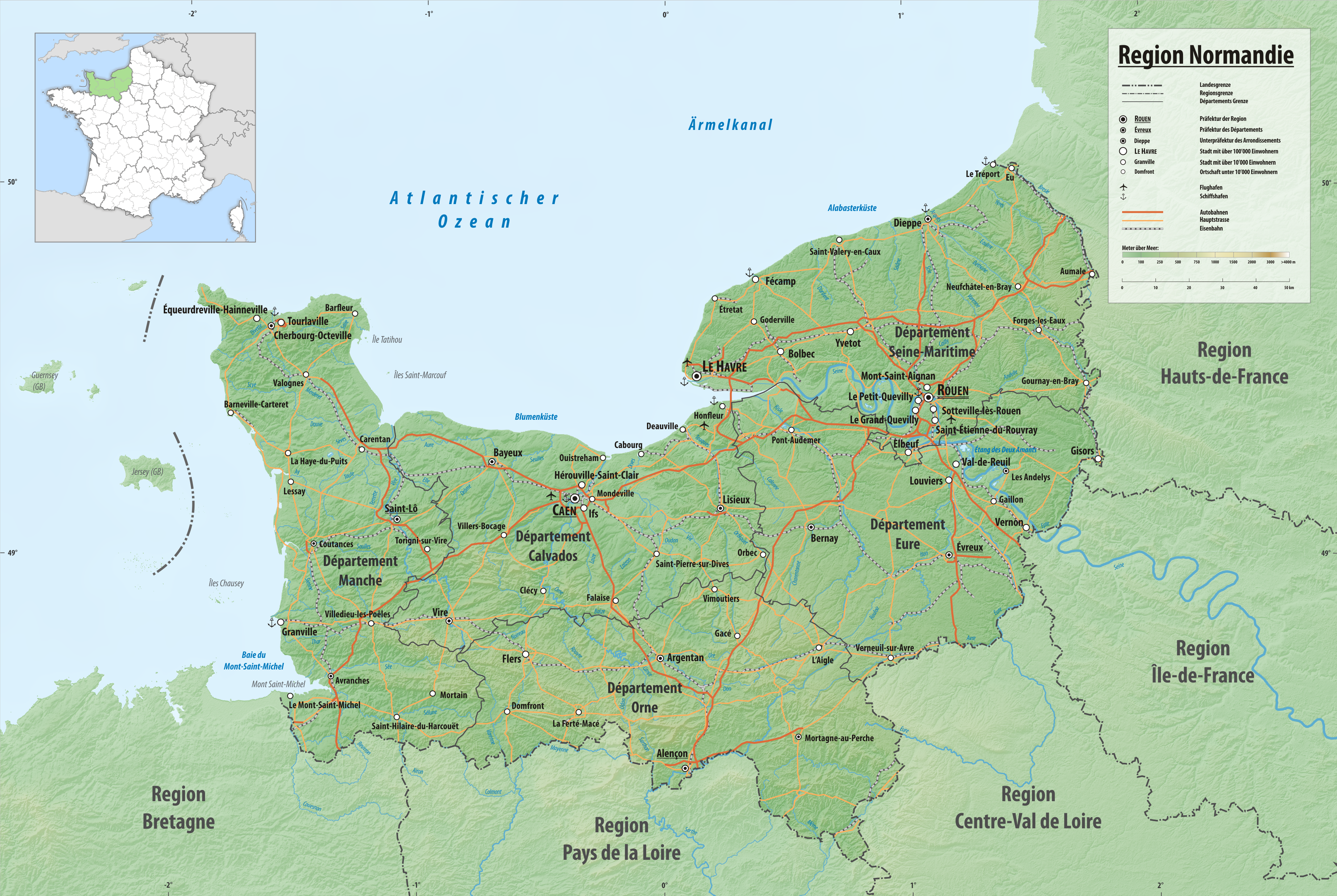
Deutsch: Reliefkarte der Region Normandie
Topographischer Hintergrund: NASA Shuttle Radar Topography Mission (public domain). SRTM3 v.2. |
||||||||
| Datum | |||||||||
| Quälle | Eigeni Arbet | ||||||||
| Urheber | Tschubby | ||||||||
| Gnähmigung (Wyternutzig vu däre Datei) |
Ich haa s Urheberrächt an däm Wärch un vereffetlig s dodermit unter däne Lizänze:
Die Datei isch lizänziert unter dr Creative-Commons-Lizänze Namensnännig – Wytergab unter glyche Bedingige 2.5 generisch, 2.0 generisch un 1.0 generisch.
Du chasch sälber e Lizänz uuswehle. |

Dateiversione
Klick uf e Zytpunkt zu aazeige, wie s dert usgsäh het.
| Version vom | Vorschaubild | Mäß | Benutzer | Kommentar | |
|---|---|---|---|---|---|
| aktuell | 13:32, 1. Nov. 2016 | | 3.691 × 2.476 (9,25 MB) | Tschubby | {{Information |Description= {{de| Reliefkarte der Region Normandie}} Topographischer Hintergrund: [http://www2.jpl.nasa.gov/srtm NASA Shuttle Radar Topography Mission] (public domain). SRTM3 v.2. |Source={{own}} |Date= 2016-02-18 |Author= [[:de:User:Ts... |
Verwändig vu dr Datei
Di folgende Sytene händ en Link zu dem Bildli:
Wältwyti Dateinutzig
Die andere Wikis bruche die Datei:
- Gebruch uf ca.wikipedia.org
- Gebruch uf es.wikipedia.org
- Gebruch uf frr.wikipedia.org
- Gebruch uf fr.wikipedia.org