Datei:Saint Pierre et Miquelon Map.svg

Gröössi vor PNG-Vorschou vor SVG-Datei: 591 × 368 Pixel. Wyteri Ufflösige: 320 × 199 Pixel | 640 × 399 Pixel | 1.024 × 638 Pixel | 1.280 × 797 Pixel | 2.560 × 1.594 Pixel.
Originaldatei (SVG-Datei, Basisgrößi: 591 × 368 Pixel, Dateigrößi: 38 KB)
| Die Datei un d Informatione derzue were us em zäntrale Mediearchiv Wikimedia Commons (Allmänd) iibunde. | Zur Bschriibigssite uff de Allmänd |
| Bschryybig |
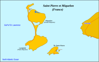
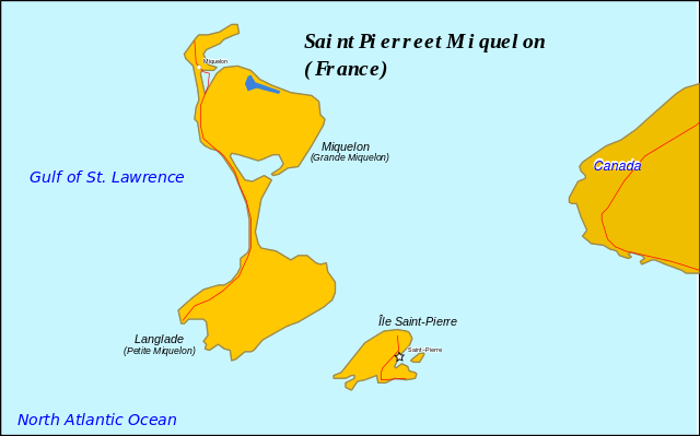
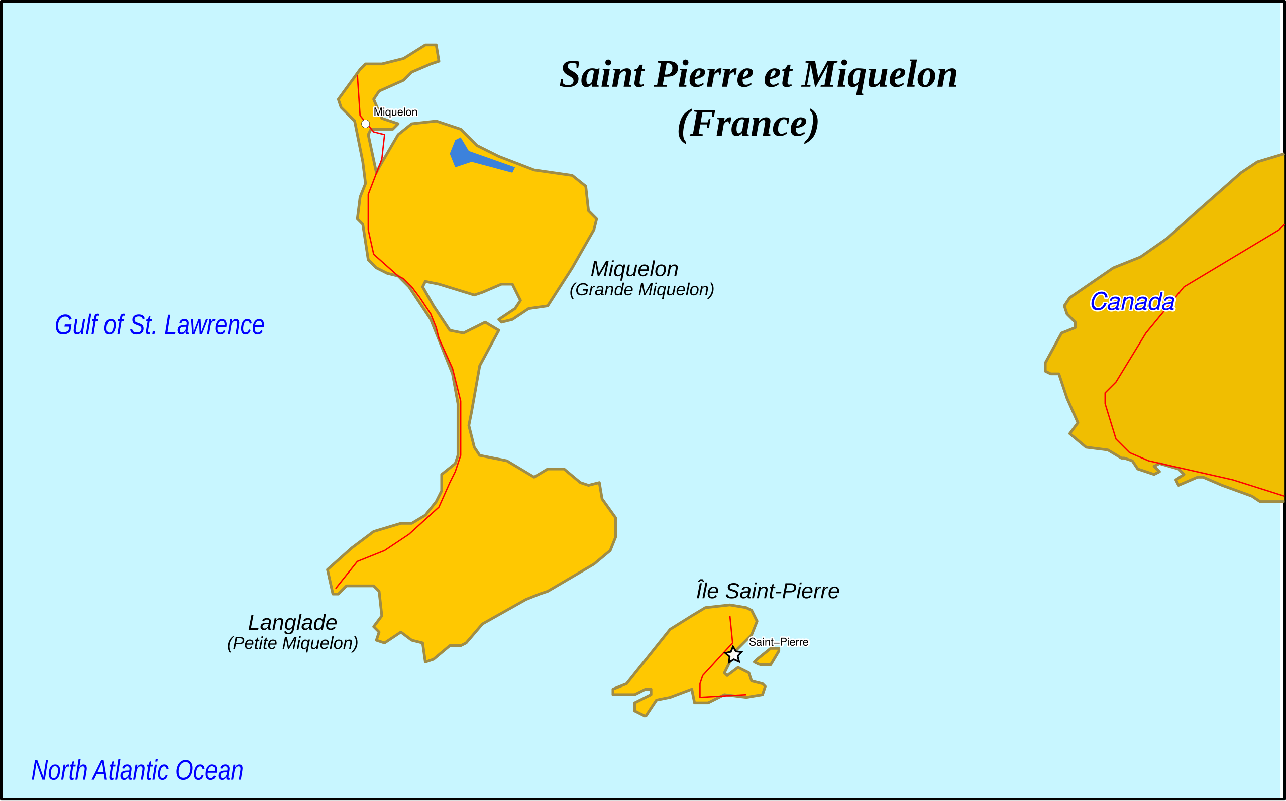
English: Map of Saint Pierre et Miquelon. Information from CIA MAP |
| Datum | original unknown |
| Quälle | outline from PlaniGlobe |
| Urheber | Planiglobe (outline), RaviC |
| Anderi Versione |
|

Lizänzierig
Die Datei isch lizänziert unter dr Creative-Commons-Lizänz Namensnännig 2.5 generisch.
- Du derfsch:
- des Wärch an anderi wytergee – des Wärch kopiere, verbreite un ibertrage
- des Wärch verändere – des Wärch aapasse
- Unter däne Bedingige:
- Namenännig – Du muesch aagmässeni Aagabe zum Urheber un dr Rächt mache, e Link zue dr Lizänz zuefiege un aagee, eb Änderige gmacht wore sin. Die Aagabe chenne in ere aagmässene Art gmacht wäre, aber nit eso, ass dr Yydruck entstoht, ass dr Lizänzgeber Dii oder Dyy Gebruch vum Wärch unterstitze un guetheiße.

|
Diese SVG-Datei enthält eingebetteten Text, der mit jedem geeigneten SVG-Editor, Texteditor oder dem SVG-Übersetzungs-Werkzeug in deine Sprache übersetzt werden kann. Für mehr Informationen siehe Über das Übersetzen von SVG-Dateien. |
Dateiversione
Klick uf e Zytpunkt zu aazeige, wie s dert usgsäh het.
| Version vom | Vorschaubild | Mäß | Benutzer | Kommentar | |
|---|---|---|---|---|---|
| aktuell | 21:10, 16. Apr. 2009 | | 591 × 368 (38 KB) | RaviC | {{Information |Description={{en|1=Map of Saint Pierre et Miquelon.}} Information from [http://en.wikipedia.org/wiki/File:Map_of_Saint_Pierre_and_Miquelon.gif CIA MAP] |Source=[http://www.planiglobe.com/omc-bin/omc_cntr?service=map&country=Cayman+Islands o |
Verwändig vu dr Datei
Di folgende Sytene händ en Link zu dem Bildli: