Datei:Uruguay location map Topographic.png

Greßi vu däre Vorschau: 571 × 599 Pixel. Wyteri Ufflösige: 229 × 240 Pixel | 457 × 480 Pixel | 732 × 768 Pixel | 976 × 1.024 Pixel | 2.128 × 2.233 Pixel.
Originaldatei (2.128 × 2.233 Pixel, Dateigrößi: 6,19 MB, MIME-Typ: image/png)
| Die Datei un d Informatione derzue were us em zäntrale Mediearchiv Wikimedia Commons (Allmänd) iibunde. | Zur Bschriibigssite uff de Allmänd |
Bschryybig
| Bschryybig |
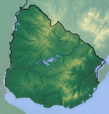
Deutsch: Positionskarte von Uruguay
Quadratische Plattkarte, Geographische Begrenzung der Karte:
English: Location map of Uruguay
Equirectangular projection, Geographic limits of the map:
|
| Datum | |
| Quälle |
Eigeni Arbet
|
| Urheber | Dr Brains |
Lizänzierig
Ich haa s Urheberrächt an däm Wärch un vereffetlig s dodermit unter däre Lizänz:

|
Des Dokumänt derf kopiert, verbreitet un/oder bearbeitet wäre unter dr Bedingige vu dr GNU-Lizänz fir freji Dokumäntation, Version 1.2 oder ere spetere Version, vereffetligt dur Free Software Foundation. S het keini uuveränderlige Abschnitt, kei vordere Umschlagstext un kei hindere Umschlagstext. E Kopii vu dr Lizänz isch verfiegbar im Abschnitt GNU-Lizänz fir freji Dokumäntation. |
If this file is eligible for relicensing, it may also be used under the Creative Commons Attribution-ShareAlike 3.0 license. The relicensing status of this image needs to be manually reviewed by an experienced user. You can help.
|
Dateiversione
Klick uf e Zytpunkt zu aazeige, wie s dert usgsäh het.
| Version vom | Vorschaubild | Mäß | Benutzer | Kommentar | |
|---|---|---|---|---|---|
| aktuell | 00:38, 10. Jun. 2012 | | 2.128 × 2.233 (6,19 MB) | Dr Brains |
Verwändig vu dr Datei
Kei Artikel bruucht die Datei.
Wältwyti Dateinutzig
Die andere Wikis bruche die Datei:
- Gebruch uf avk.wikipedia.org
- Gebruch uf azb.wikipedia.org
- Gebruch uf ca.wikipedia.org
- Gebruch uf ckb.wikipedia.org
- Gebruch uf en.wikipedia.org
- Gebruch uf fa.wikipedia.org
- Gebruch uf he.wikipedia.org
- Gebruch uf ja.wikipedia.org
- Gebruch uf ml.wikipedia.org
- Gebruch uf pa.wikipedia.org
- Gebruch uf shn.wikipedia.org
- Gebruch uf simple.wikipedia.org
- Gebruch uf si.wikipedia.org
- Gebruch uf th.wikipedia.org
- Gebruch uf uk.wikipedia.org
- Gebruch uf uz.wikipedia.org