Le Bono
(Witergleitet vun Bono (Morbihan))
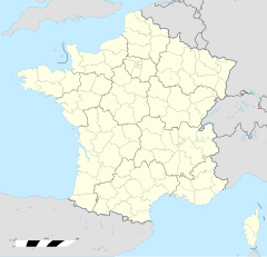
Le Bono oder Bono (bretonisch Ar Bonoù) isch e franzesischi Gmai im Département Morbihan in dr Region Bretagne.
| Le Bono | |
 Le Bono | |
| Verwàltung | |
|---|---|
| Land | |
| Region | |
| Département | Morbihan (56) |
| Arrondissement | Lorient |
| Kànton | Vannes-2 |
| Kommünàlverbànd | Golfe du Morbihan - Vannes Agglomération |
| Àmtliga Nàma | Le Bono |
| Maire | Yves Dreves (2014-2020)[1] |
| Code Insee | 56262 |
| Poschtlaitzàhl | 56400 |
| Iiwohner | |
| Iiwohner | 2.581 |
| Flech | 5,96 km2 |
| Bevelkerungsdicht | 368,79 Iiw./km2 |
| Làg | |
| Koordinate | 47° 38′ 25″ N, 2° 57′ 03″ W / 47.640277777778°N,2.9508333333333°WKoordinate: 47° 38′ 25″ N, 2° 57′ 03″ W / 47.640277777778°N,2.9508333333333°W |
| Heche | 9 m |
| Website | |
| http://www.lebono.fr | |
D Gmai ghert zum Kanton Vannes-2 un zum Arrondissement Lorient.
Geografi
ändereLe Bono lyt 14 km vu Vannes un 33 km vu Lorient uf ere Hechi zwische 0 m un 42 m iber Normalnull.
Gschicht
ändereLe Bono isch bis anne 1947 e Dail vu dr Gmai Plougoumelen gsii. Urspringli het s Dorf em Chloschter Saint-Gildas-en-Rhuys ghert un isch am 19. März 1669 an dr Ritter Pierre de Montigny, dr Herr vu Kerisper verchauft wore.
Verwaltig
ändereDr Maire vu Le Bono isch dr Yves Dreves. Le Bono ghert zum Kommunalverband Golfe du Morbihan - Vannes Agglomération.
Bevelkerigsentwicklig
ändere| Johr | 1962 | 1968 | 1975 | 1982 | 1990 | 1999 | 2008 |
| Yywohner | 1.622 | 1.555 | 1.561 | 1.633 | 1.747 | 1.859 | 2.199 |
Dialekt
ändereDr traditionell Dialäkt vu Le Bono ghert zum Bretonisch.
Kultur un Böuwärch
ändere- Chilche (1956)
- Chapelle Notre-Dame-de-Becquerel, Kerbiquet
- Dolmen Rocher, Minguionnet
- Tumulus Rocher, Coët Bugat
-
Chilche -
Chapelle Notre-Dame-de-Becquerel -
Tumulus Rocher -
Ortsschild
Weblink
ändere Commons: Le Bono – Sammlig vo Multimediadateie
- http://www.le-bono.fr
- Le Bono uf geobreizh.com (Internet-Archive)
Fueßnote
ändere- ↑ Liste des maires au 25 avril 2014 (data.gouv.fr)
Normdate: SUDOC/IdRef: 155426699 | VIAF: 1219148574299324430008
