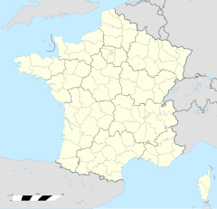
Saint-Pabu
Saint-Pabu (bretonisch Sant-Pabu) isch e franzesischi Gmai im Département Finistère in dr Region Bretagne.
| Saint-Pabu | |
 | |
| Verwàltung | |
|---|---|
| Land | |
| Region | |
| Département | Finistère (29) |
| Arrondissement | Brest |
| Kànton | Plabennec |
| Kommünàlverbànd | Pays des Abers |
| Àmtliga Nàma | Saint-Pabu |
| Maire | Loïc Gueganton (2014-2020)[1] |
| Code Insee | 29257 |
| Poschtlaitzàhl | 29830 |
| Iiwohner | |
| Iiwohner | 2.067 |
| Flech | 9,94 km2 |
| Bevelkerungsdicht | 193,56 Iiw./km2 |
| Làg | |
| Koordinate | 48° 33′ 57″ N, 4° 36′ 10″ W / 48.565833333333°N,4.6027777777778°WKoordinate: 48° 33′ 57″ N, 4° 36′ 10″ W / 48.565833333333°N,4.6027777777778°W |
| Heche | 25 m |
| Website | |
| http://www.saint-pabu.bzh | |
D Gmai ghert zum Kanton Plabennec un zum Arrondissement Brest.
Geografi
ändereSaint-Pabu lyt am Ärmelkanal am Atlantik, 73 km vu Quimper un 21 km vu Brest uf ere Hechi zwische 0 m un 56 m iber Normalnull.
Gschicht
ändereSaint-Pabu isch zum erschte Mol gnännt wore anne 1230 as Seintpabu (1544 Sainct Pabu).
Verwaltig
ändereDr Maire vu Saint-Pabu isch dr Loïc Gueganton. Saint-Pabu ghert zum Kommunalverband Pays des Abers.
Bevelkerigsentwicklig
ändere| Johr | 1962 | 1968 | 1975 | 1982 | 1990 | 1999 | 2008 |
| Inwohner | 1.341 | 1.283 | 1.278 | 1.380 | 1.392 | 1.479 | 1.849 |
Dialekt
ändereDr traditionäll Dialäkt vu Saint-Pabu ghert zem Bretonisch.
Böuwärch
ändere- Chilche Saint-Pabu (1624)
Bilder
ändere-
Hafe vu Saint-Pabu -
Dotedänkmol
Weblink
ändere Commons: Saint-Pabu – Sammlig vo Multimediadateie
Fueßnote
ändere- ↑ Liste des maires au 25 avril 2014 (data.gouv.fr)
