Telgruc-sur-Mer
Telgruc-sur-Mer (bretonisch Terrug) isch e franzesischi Gmai im Département Finistère in dr Region Bretagne.
| Telgruc-sur-Mer | |
 | |
| Verwàltung | |
|---|---|
| Land | |
| Region | |
| Département | Finistère (29) |
| Arrondissement | Châteaulin |
| Kànton | Crozon |
| Kommünàlverbànd | Presqu’île de Crozon-Aulne maritime |
| Àmtliga Nàma | Telgruc-sur-Mer |
| Maire | Yves Le Moigne (2014-2020)[1] |
| Code Insee | 29280 |
| Poschtlaitzàhl | 29560 |
| Iiwohner | |
| Iiwohner | 2.124 |
| Flech | 28,29 km2 |
| Bevelkerungsdicht | 73,81 Iiw./km2 |
| Làg | |
| Koordinate | 48° 13′ 53″ N, 4° 21′ 23″ W / 48.231388888889°N,4.3563888888889°WKoordinate: 48° 13′ 53″ N, 4° 21′ 23″ W / 48.231388888889°N,4.3563888888889°W |
| Heche | 93 m |
 Telgruc-sur-Mer Telgruc-sur-Mer (Frànkrich) | |
| Website | |
| http://www.telgruc-sur-mer.bzh | |
D Gmai ghert zum Kanton Crozon un zum Arrondissement Châteaulin.
Geografi
ändereTelgruc-sur-Mer lyt uf dr Halbinsle Crozon am Atlantik im Regionale Naturpark Armorique (Parc naturel régional d'Armorique), 32 km vu Quimper un 20 km vu Brest uf ere Hechi zwische 0 m un 145 m iber Normalnull.
Gschicht
ändereTelgruc-sur-Mer isch zum erschte Mol gnännt wore im 11. Jh. as Telchruc (1236 Thelgruc, 13. Jh. Thelgruc, 1368 Telgruc, 1395 Telgruch, 1410 Telgruc, 1516 Telgruc).
Verwaltig
ändereDr Maire vu Telgruc-sur-Mer isch dr Yves Le Moigne. Telgruc-sur-Mer ghert zum Kommunalverband Presqu’île de Crozon-Aulne maritime.
Bevelkerigsentwicklig
ändere| Johr | 1962 | 1968 | 1975 | 1982 | 1990 | 1999 | 2008 |
| Inwohner | 1.875 | 1.901 | 1.873 | 1.838 | 1.811 | 1.822 | 2.042 |
Dialekt
ändereDr traditionäll Dialäkt vu Telgruc-sur-Mer ghert zem Bretonisch.
Kultur un Böuwärch
ändere- Chilche Saint-Magloire
- Fontaine Saint-Divy (16. Jh.)
- Pont du Launay (1912)
- Dolmen de Pennarun
Bilder
ändere-

Chilche Saint-Magloire -
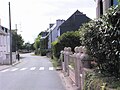
Hyyser


Weblink
ändereFueßnote
ändere- ↑ Liste des maires au 25 avril 2014 (data.gouv.fr)
Normdate: VIAF: 244780396