Floostroff
Floostroff (lothrìngisch; frànzeesch Flastroff, ditsch Flasdorf) ìsch e frànzeesche Gmein ìm Département Moselle ìn dr Region Grand Est (bìs 2015 Region Lothrìnge).
| Floostroff | |
 | |
| Verwàltung | |
|---|---|
| Land | |
| Region | |
| Département | Moselle (57) |
| Arrondissement | Thionville |
| Kànton | Bouzonville |
| Kommünàlverbànd | Bouzonvillois-Trois Frontières |
| Àmtliga Nàma | Flastroff |
| Maire | Roland Schneider (2014-2020)[1] |
| Code Insee | 57215 |
| Poschtlaitzàhl | 57320 |
| Iiwohner | |
| Iiwohner | 355 |
| Flech | 8,38 km2 |
| Bevelkerungsdicht | 37,83 Iiw./km2 |
| Làg | |
| Koordinate | 49° 22′ 19″ N, 6° 32′ 05″ E / 49.371944444444°N,6.5347222222222°EKoordinate: 49° 22′ 19″ N, 6° 32′ 05″ E / 49.371944444444°N,6.5347222222222°E |
| Heche | 237 m |
| Dialäkt: Elsassisch |
D Gmein ghert zem Kanton Bouzonville un zem Arrondissement Thionville.
Geogràfi
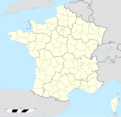
ändereFloostroff lijt zehn Kilometer nerdlich vun Bouzonville in dr Neh vun dr Granz em Sààrlànd uf re Heche zwìsche 214 und 307 m ìwer em Meeresspiejel.
Züe Floostroff ghert àui no dr Ortsdeil Zeurange (Zeringen).
Gschìcht
ändereFloostroff ìsch zem erschte Mol gnannt worre ànne 1182 àls Fladerdorpht (1184: Flaisdorf, 1617: Flestroff, 1689: Flostroff, 1708; Flasdorf).
Ìm Johr 1661 ìsch d Gmein züe Frànkrich kumme. Vun 1871 bìs 1918 hàt sa zem ditsche Richslànd Elsàss-Lothringe ghert.
Verwàltung
ändereDr Maire vun Floostroff ìsch dr Roland Schneider. Floostroff ghert zem Kommünàlverbànd Bouzonvillois-Trois Frontières.
Bevelkerungsentwìcklung
ändere| Johr | 1968 | 1975 | 1982 | 1990 | 1999 | 2008 |
| Inwohner[2] | 398 | 370 | 371 | 357 | 330 | 304 |
Dialekt
ändereDr lothrìngisch Dialekt vun Floostroff ghert zem Moselfrankisch.
Böiwark
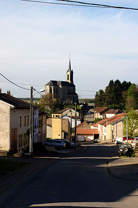
ändere- Kìrich Saint Eloi (1858-66)
Weblink
ändereReferanza
ändere- ↑ Liste des maires au 25 avril 2014 (data.gouv.fr)
- ↑ INSEE: Population et logements par commune depuis le recensement de 1962 (1961 pour les Dom) à 1999
